Tuesday, 29 December 2009

Helm Crag

Drove out to Grasmere, tried the car park (which costed £6.50 for the day – eek!!!) and parked up on the road.

Our route took us past the Youth Hostel and along the road that heads up Easedale with the general hordes.  About a mile from where we'd left the cars, we turned right onto another lane which skirts around the bottom of Helm Crag to the east and then north and followed the valley on the northern side of the ridge behind the crag.


Helm Crag from the east.

Anyway, we headed off around the eastern end of the crag and followed the valley...


 Our route up the valley.


Helm Crag from the north.


Pete and Paul and the view back down the valley.


Keith leading the way.

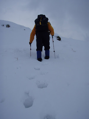
crossed the stream (Green Burn) and then started heading up the northern side of the ridge. It was quite steep, but not for very long and Keith broke ground for a while until he got back onto the tracks we’d been following.


Our illustrious leader breaking ground up the side of the ridge.


It was hard going for a while!!

Keith and Pete climbed up onto the highest point of the ridge to the west as we topped out, while Paul and I stopped for a chocolate break and then we all headed east along the ridge.


The view across Easedale.


It was pretty cool and although it was very windy in a couple of places, because we kept rising and dropping, it wasn’t all the time and it certainly wasn’t as bad as it was on some of the tops around.  We finally reached the top of Helm Crag and had another quick break while Pete climbed up onto the very top of the boulders.


Pete and Keith on 'The Howitzer'.


Keith and the view up Easedale.


The view across Grasmere from the end of Helm Crag.

Then we headed down as great speed, but even then we couldn’t keep up with Pete, who seemed to be on a mission.

Monday, 28 December 2009

The Langdales

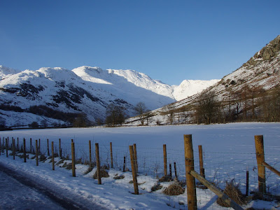
Awoke to beautiful blue skies and sunshine.  However, it was icy and Pete nearly fell over on the pavement outside the B&B.

Keith had suggested the Langdales the previous evening and I'd thought that maybe I'd get them to drop me off in Elterwater on their way and I'd then find a route back to Ambleside across the fields, a distance of about 6 miles or so.  In the end Paul persuaded me to go with them, although I very much doubted my skills on what was now snow with a layer of ice on the top.


We parked up at the Dungeon Ghyll Hotel with some difficulty.  Pete immediately got his car stuck because it dropped through the ice layer on top of pristine snow.  Keith used his ice axe to break the ice layer up and he was then able to move the car again.  Then we had the fun of finding £5.40 to pay for each car (and none of us had any change), but luckily there are change machines in the hotel toilets - how organised is that!!?  The temperature seemed even lower than it had the previous two days and I had to put my big jacket on over my other walking gear while we were kitting up.

We started off across the fields up the valley, stopping to take photos...


pet horses...


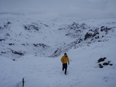
put on crampons, take off jackets, take off crampons, stop for a pee and generally faff about a lot.  I wasn’t terribly keen on the whole idea and I could feel Keith's frustration, so when we got to the start of the steeper section and Pete said that he wasn’t going any further because his back was killing him, I said I’d go back with him and Paul went on with Keith.

Sunday, 27 December 2009

Borrowdale to Sprinkling Tarn (or Not the Corridor Route)

After an enormous breakfast we drove out to Keswick – where there’d obviously been some considerable amount of snow overnight - all the way around the town and then up Borrowdale.  The camping barn that Keith and I stayed at is in Rosthwaite, right near the turning to Seathwaite in Seatoller.  We took the turning and the road was pretty snowy, but we arrived at Seathwaite and parked up, kitted up (my boots were already sodden) and headed off up the valley.


Pete, Keith and Paul heading up the main valley.

I don’t know why, but I was expecting to see two valleys ahead of us, but in the event, Styhead Gill, was a hanging valley off up to the right.


The view back down the main valley.


It was steep for a while, but not really that bad and we followed the gill all the way to Styhead Tarn.


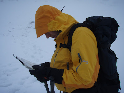
Keith perusing the map.


Pete investigating the Mountain Rescue box - he just couldn't help himself.

Up above there a ways we came to a Mountain Rescue box and stopped there to suss out our way on.  I was helping myself to some hot chocolate and a family of five with a bonkers spaniel arrived and took off in exactly the direction that we wanted.  The spaniel never stopped, it's tail was like a windmill and it was running around, jumping in snowdrifts, biting snow and generally just bonkers - I have no idea where it got the energy from, the snow was often belly deep or more on it.

After a bit of debate, Paul and I followed the family and Keith disappeared off to the right.  Pete eventually followed Keith, but over the first hummock we saw them again and they dropped down to the path to meet us.  The cloud had lifted quite a bit by now and it was getting easier to see our surroundings, which was helpful.


The view back down to Styhead Tarn.

We continued on up the route the family were taking until we turned right a bit and headed off up what I thought was a side valley to start with.  I was discussing with Keith where we were when I realised that he was right, we were heading straight for Sprinkling Tarn - we’d missed the start of the Corridor Route.  We debated what to do and I suggested what I'd originally planned to do, which was to drop down Ruddy Gill, just beyond Sprinkling Tarn, so we continued on up to the tarn.  In fact we’d walked some way out onto it before we realised where we were!!!

We quickly retreated and decided that given the conditions, the clag had returned with a vengeance, it was probably as well to head back down.  This we did, with another stop at the MR box, where I shared my hot chocolate with Pete and Keith.  We then continued down and I managed to keep up until we got to the top of the steep section down into the main valley, which by that time was more slush than anything.


Keith and Pete set off in front and got further...


and further...


and further in front.

I gave up trying to keep up after wrenching both knees, one step after another, so by the time we got to the wall, they were on the main track at the bottom and heading for the cars – last time I share my hot chocolate with either of them!!!

Saturday, 26 December 2009

Boxing Day - Blencathra

Paul, Keith and I got up at 7am on Boxing Day morning and left at 8am. By 9:30 we had arrived at the garage just off the M6 at the Penrith junction, where I texted Pete to let him know where we were.  He was only at junction 35, so I told him not to hurry and we drove on to the foot of Blencathra, parked up on the side of the A66 and ate our lunch while we waited.  We'd driven through snow showers as we came over the tops near Shap, but by the time Pete arrived and we got our walking gear on it was fine again and the sun was peeping through the cloud.

The first part was really icy and the others disappeared some distance ahead. When they waited and I caught up, I suggested that it was a waste of time us walking together as I was so slow.  Keith was right though, the ice soon disappeared and from there on the snow was soft and easy to walk in.


Clouds to the south.


Pete waiting for us to catch up (he did a lot of that!!).

We went up over the end of the ridge (in effect, although I only realised this on the way down) and dropped down into the valley behind the ridge, running parallel to the road.


The valley behind the summit ridge.

We walked up to the tarn and I saw most people heading off to the left up a straightforward slope.  Keith and Paul had started off to the right to Sharp Edge, but I decided that it looked a bit too ‘technical’ for me and my little crampons (that I never got around to putting on anyway - probably just as well because I'd never used crampons before!) so I decided to go to the left, while Pete followed the others.  As I started heading away, Paul left Keith and Pete and came and joined me, saying that it wasn’t a good idea to split up as the top of Blencathra was still shrouded in cloud.


Sharp Edge.


We plodded up the hill and onto the ridge proper to some spectacular views of the surrounding countryside to the east and southwest-ish towards Keswick.


The view south from the ridge.


In the end we arrived at the top long before Keith and Pete even appeared on the horizon and we took some photos of the views (the cloud cleared as we approached) and sat drinking hot chocolate while we waited for them.  It transpired that the ridge had been a bit more on the ‘technical’ side than even they’d anticipated and Keith had had to hand his ice axe to Pete at one point!! Darn glad we didn’t go that way!!


The view from the summit to the southwest.


The view towards Derwent Water.


Pete approaching Paul, who was enjoying a hot chocolate.

We then headed back down the ridge and went off the far end.


Our route back down.

Paul and Keith went on ahead and Pete and I realised that we’d missed the path back down the way we’d come up, so he went back up slightly to pick up that path.  I carried on down because I knew the original route was really icy at the bottom and it was just as well because Paul and Keith were waiting at the very bottom of the path, tucked completely out of sight.  Back on the flat, Keith went streaking off leaving me and Paul to slip and slide our way along the lane that dropped back down to the pub and so to the cars.

Monday, 21 December 2009

Winster Christmas Tree


The village Christmas tree next to the Market Place in Winster.

Sunday, 20 December 2009

The Elevator

Keith and Pete went back to the Elevator the next day, placed some more hangers and dropped down into a rifty chamber below some 4m wide by 16m long.  There is a clear way on because this is the way that the boulders have gone as they rumbled on down, but given the sheer quantity of 'hanging death' at the very top of the pitch, it was decided to leave well alone, at least for the foreseeable future.

Saturday, 19 December 2009

More photos from Water Icicle

I'd been helping with fundraising for DCRO (Derbyshire Cave Rescue Organisation) during the morning of the next Saturday, so I arrived at Derby Lane in the early afternoon.  The ground was like concrete after all the frosts, so I decided to continue further up the lane than we've been parking recently.  I figured that I would be able to get as far as Pete had gone.  I was pleasantly surprised to find that there was no sign of his car as I headed towards the slope leading up to the end of the lane, but unfortunately I got into the rutted part of the track and the ruts began to get really deep.  Given that the ground was like concrete and I'd already scraped the exhaust a couple of times, I stopped and reversed a bit, but then couldn't get going again.  I reversed further back and tried to get across the ruts, but in the process got the car completely stuck at an angle across the track.  It's probably 40-50 feet wide at that point, so I knew I wouldn't inconvenience the farmer, so I got changed and went underground about 2pm - it was so cold on the surface it felt positively balmy.

I expected to find the boys at the end of Cherty Two Passage, but having crawled over the first bank, I realised that there was no noise coming from up ahead and I retraced my steps and followed Urchin Passage until I came to the pitch.  Paul asked me where I'd left the car and I said 'where it got stuck'.  Apparently he'd sent me a text message saying not to try to get all the way along the track because he'd had to tow Pete out - whoops!!

Anyway, there was much boulder moving going on and lots of falling rocks as more and more of them headed down the pitch, which was opening up nicely.  I got bored after a bit and Pete lent me his camera and I went off to take pictures of some more of the formations on the floor.

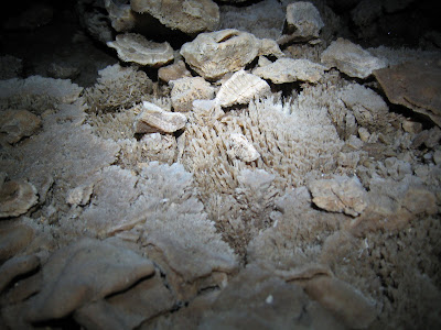
Calcite crystals and a piece of very jagged rock.

More crystals near the Sea Urchins.

A drip crater.

Several boulders in both passages are covered in these yellowish calcite crystals.

Boulders covered in calcite, where the rock has then worn from inside the covering of calcite.

Football-sized chunks of calcite, clearly showing the layers of calcite that have been deposited.

Mud formations formed by drips.

Mud formations formed by drips.  The rings at bottom right go down to a depth of maybe 20cm.

These mud formations are classic for an area with lots of drips, but unusual because they are not vertical.  Did the floor shift?

Keith having a peek down the hole they'd opened up.

After another while, I wandered back to the digging effort, by which time a hanger had been placed in the roof of the main passage and Keith had hung off this while they continued to shift boulders - some had needed considerable 'persuasion'.

But in the end three hours or so of standing in Morrisons packing people's shopping took their toll and as I was also starting to get cold, I decided to head for the car.  It was snowing when I reached the surface and dark and I got the car going and cowered behind the tail gate (fortunately the car happened to be pointing into the wind, which was convenient).  I debated waiting for the others to help me get the car out, but decided to have a go at rocking it out myself, which paid off.  I left a note on Paul's car, went back to the shaft to check they weren't on the way up and headed for home.

Wednesday, 16 December 2009

Peak Forest / Old Dam Walk

I thought I'd left early enough to get to Peak Forest, but when I realised that I'd taken a longer route than necessary by going along the A6 and through Mill Dale to Tideswell and then run into really thick fog, I was beginning to wonder.  I also wasn't sure where we were parking, but I guessed right and managed to park up outside the church.  I saw Paul arrive soon after, so knew I was in the right place.

In the end there were only five of us - Paul, Peter, Jill and a guy that I recognised from the Carsington walk, whose name is Phil.  We headed off up to Eldon Hole and then dropped back down the main field to an enormous rake that runs across the fields; I can't believe I've never noticed it before.  We took a footpath on the left just past the rake and followed it up and over the top of the hill to Watts Plantation...

Heading north and dropping down from the top of the hill.

heading more or less north until we came to an enormous shaft, covered by a large grate.

The others stood on the grating over the shaft.

The shaft had a diameter of something like six feet and appears to continue at the bottom.

From there, we headed back slightly and along the eastern side of the hill until we eventually dropped right down into the bottom of the valley.  We then missed a turn, which would have taken us across the fields and cut the corner, but we continued down onto Old Dam Lane and turned east along it until we reached the Limestone Way.  After a steep climb up and over the hill we crossed the A623 and continued along a lane opposite, following the Limestone Way.

Along the lane a way, we turned right onto a lane which followed the route of the Pennine Bridleway and dropped steeply into the valley.  After realising we'd missed the path, we returned to the very bottom of the hill and took a path that led along the bottom of the right-hand side of the valley to Damside Farm.

Dam Dale.

From there it was a simple walk along the lane back into Peak Forest and the cars.

Saturday, 12 December 2009

Photos and surveying of new passage in WICC

After much debate, Keith and Pete decided to get Simon Brooks involved to get the new passage photographed and surveyed and an article ready to put in Descent for late January / early February, so the weekend after the breakthrough saw Simon and Paul joining us in WICC.

Pete opened up the scaffolding and Paul and I followed him down into the new passage, while Keith and Simon surveyed through the boulder choke.  I headed off with a roll of tape to mark the route we'd taken the previous week and I was pleasantly surprised at the lack of damage.  I used up the 250m roll before I got back to the big chamber, which Keith had since christened Three Way Chamber, which meant that we had more passage than perhaps we'd realised.  By the time I finished off right back to the breakthrough, the others were back along the main passage and Simon was busy taking photos.

 Keith in the bottom of the dig, with the hole below (photo Simon Brooks).

Pete, myself and Keith at the breakthrough point - we came through where the light is shining from (photo Simon Brooks).

The passage from which we emerged into Three Way Chamber (photo Simon Brooks).

Keith and Pete in Three Way Chamber (photo Simon Brooks).

Keith in the start of the continuing main passage, named Urchin Passage, after the formations (photo Simon Brooks).

Keith in Urchin Passage - note the square top right hand side of the passage (photo Simon Brooks).

Pete and Keith in Urchin Passage (photo Simon Brooks).

Pete and myself in Urchin Passage (photo Simon Brooks).

Keith and Pete in Urchin Passage (photo Simon Brooks).

Pete in Urchin Passage - note the smaller size of the passage (photo Simon Brooks).

Keith investigating the boulder choke at the end of Urchin Passage (photo Simon Brooks).

Once the photography was done, Simon, Keith and I fetched Simon's DistoX (a great bit of gear, similar to the measuring instruments used by estate agents, which has a laser beam, which you point at a surface and measure the distance between the Disto to the surface - much better than a tape measure!) and started surveying Urchin Passage.  Once we got used to what we were doing it didn't take long, but we were surprised at the direction the passage appeared to be trending; with all its twists and turns it had been difficult to get a feel for where it was going.  While the photography had been going on, I'd had a closer look at the place where water had been sinking and discovered that it was quite a bit deeper than originally thought.  When we reached this point during the surveying, Keith stepped onto a large boulder to point the Disto down a gap in the boulders and was greatly alarmed when the boulder dropped a few inches and then wedged again!!  He flew out of the alcove back onto terra firma!  This pitch was later called "The Elevator" as Keith said that was what it felt like.  Personally, I'm glad I didn't get to find out!

Once we finished, we went to take a look at the smaller passage off Three Way Chamber and found Pete and Paul at the far choke, having spent some time 'progging'.  They'd already shifted quite a large quanity of stone and some of this was already lining one wall of the passage.  This passage is interesting in that all the small stalagmites have been broken and are still lying in place.  Taking that into account, the chokes on both passages and the other 'damage' throughout the new cave, leads us to believe that there was a major earth movement at some point in the distance past, which broke formations and choked the avens.  Was the 'original' passage also the same when t'owd man first investigated it?  Did he really break up the formations to remove them or were they already broken?  We'll probably never know, but it does open up some interesting questions.

Pete and Paul were very proud of the progress they'd made, having at one point cleared the small aven they were digging across, but then a little bit more 'progging' had produced a massive downpouring of boulders and now the aven is clear for the bottom 20 feet or so!!  Apparently they moved very fast!  Keith pointed out a collection of chert nodules in the right-hand wall near the boulder choke in the shape a number two - it's these nodules that have since given the passage its name of Cherty Two Passage.

The cherty 'two'.

While Keith joined the 'progging' team, Simon and I went to collect the Disto from Three Way Chamber and between the two of us surveyed Cherty Two Passage.  Once this was done we headed for the surface.