Parked up and started off up the lane, in my case trying to get warm. When we got to the cafe in Edale, Paul suggested that we stop for sustenance and I’d just realised that I’d forgotten to have toast for breakfast, so I agreed and had a sausage butty.
We started heading up to Grindsbrook Knoll, but realised that with the direction of the wind we’d be better going up Ringing Roger, so that’s what we did. Stopped in the same spot at the top and, out of the wind in the sun, it was quite warm. Found the path that we completely missed in January and toddled along the edge to a big pile of rocks, where we stopped for some lunch. Had a text from Keith to say they were staying home – don’t blame them.
We were stopped by three lads who wanted one of us to take a photo of them – hope it was OK. We crossed a tributary for the Grindsbrook – which I don’t remember at all!! – and then the top of Grindsbrook proper, heading onto the path towards Grindsbrook Knoll where we lost the crowds. Once again we stopped, out of the wind just off the top to empty our flasks. Then it was just the long track down to the field above Edale, where we met a huge group of people, adults and kids and a guy following them muttering at them. Stopped for tea at Calver Outside on the way home.
Saturday, 27 November 2010
Sunday, 21 November 2010
Ashover and Ogston Reservoir Walk
Got kitted up and headed off - Paul Chandler, Gill, Graham, Phil, his mate Chris, us and Brenda, the older lady, a PDMHS member who did the Matlock walk. Paul C pointed out a small field opposite the car park entrance, where Dumblehole Swallet is apparently – sounds pretty tight! We walked down through the village, crossed the fields past a sough and climbed steeply up an old path, heading generally south. We stopped above Overton and Overton Hall where there was a lot of mining activity. From there we contoured up along the side of the edge through the trees, a very pretty path, to an open mined section, with a chimney below us. We could see Hardwick Hall in the far distance. Continuing up through the trees, we passed below Cocking Tor and turned off to the left near Ravensnest, still near the top of the hill along the edge of the wood until we climbed out into the fields. We stopped for ‘elevenses’ at a ready-made picnic site of rock table and tree trunk seats with fantastic views. A couple of fields further on we dropped down through Butterley Top Farm (wrongly!) to a lane. We turned right onto it and after a couple of hundred yards, left into Coldharbour Lane, on the corner of which there used to be a quarry or reservoir (depending on whether you believe Paul C or Chris!!) - it's gone now anyway. Part way along we crossed into a parking area with stunning views to the northeast. This was where we stopped for butties.
After re-fuelling we continued along Coldharbour Lane, turning left at the far end to drop down through the woods to the remains of Trinity Chapel, which we explored for a while. The path continued east, dropping steadily down the fields into Brackenfield and so to the lane running along the western shore of Ogston Reservoir. There were a few wildfowl about, but nothing that out of the ordinary until we spotted two large white gooselike birds, which I think were juvenile Whooper Swans as they had grubby brown plumage on the back of their necks. As usual, the pounding along a flat path made my legs start to ache and by the time we Woolley (which Paul said was where sheep live!), I was beginning to wonder if perhaps 9 miles was a bit over ambitious considering my general lack of exercise recently. I was very disappointed to find the Public Conveniences were closed too as by this time it was becoming an issue. Back in the fields we followed a pretty footpath, paralleling one of the feeders for the reservoir. Paul C pointed out a strange half circle shaped object across the valley at one point, which he said was one of the adit entrances to Woolley Moor Colliery. It’s strange to think that the big coal mines are so close. In the end I waited until we were back on a country lane before I found a suitable place to disappear into the undergrowth. Luckily Paul had waited for me because the others had got quite a distance ahead as we arrived in Milltown. We traversed around the top of Fallgate Quarry and then further along past Hockley Quarry until we found ourselves back in the outskirts of Ashover. A very nice walk and apart from a bit of damp at the very beginning and very end, it had stayed dry, always a bonus!
After re-fuelling we continued along Coldharbour Lane, turning left at the far end to drop down through the woods to the remains of Trinity Chapel, which we explored for a while. The path continued east, dropping steadily down the fields into Brackenfield and so to the lane running along the western shore of Ogston Reservoir. There were a few wildfowl about, but nothing that out of the ordinary until we spotted two large white gooselike birds, which I think were juvenile Whooper Swans as they had grubby brown plumage on the back of their necks. As usual, the pounding along a flat path made my legs start to ache and by the time we Woolley (which Paul said was where sheep live!), I was beginning to wonder if perhaps 9 miles was a bit over ambitious considering my general lack of exercise recently. I was very disappointed to find the Public Conveniences were closed too as by this time it was becoming an issue. Back in the fields we followed a pretty footpath, paralleling one of the feeders for the reservoir. Paul C pointed out a strange half circle shaped object across the valley at one point, which he said was one of the adit entrances to Woolley Moor Colliery. It’s strange to think that the big coal mines are so close. In the end I waited until we were back on a country lane before I found a suitable place to disappear into the undergrowth. Luckily Paul had waited for me because the others had got quite a distance ahead as we arrived in Milltown. We traversed around the top of Fallgate Quarry and then further along past Hockley Quarry until we found ourselves back in the outskirts of Ashover. A very nice walk and apart from a bit of damp at the very beginning and very end, it had stayed dry, always a bonus!
Saturday, 13 November 2010
Goyt Valley & Shining Tor
I drove us to Errwood Reservoir and, still half asleep, drove half way up the car park to park, forgetting that we’d be coming back along the road at the bottom – doh! Set off along the road towards Shooter’s Clough Bridge in glorious, very bright(!), sunshine. Just past the next car park we turned up the hillside and began the steep climb up the side of the valley. It started off steadily, became pretty damn steep up to the gate, then levelled off a bit. Two guys came up behind us, steadily catching up, but they disappeared down into Shooter’s Clough as we climbed on up alongside the wall. At the next junction we had fantastic views south over Shutlingsloe and we turned right, heading northwest to the very top of Shining Tor, from which there were more spectacular views. It was also a rather busy spot, as we discovered as we sat to sit and eat our butties. It was also darn cold! I ended up keeping my gillet on as we headed north along the ridge, because the wind just cut through you. It was something in the region of two miles all the way along to Pym Chair, where we stopped for another brief drink/butty stop. We saw the lady Park Ranger yet again – she must spend every Saturday up there!!Following the road, we dropped down quite a way and took a footpath off to the right to pick up the end of Foxlow Edge, above the small ‘pepper’ pot folly. This is “a small shrine or chapel, erected by the Grimshawe family to the memory of Miss Dolores de Ybarguen, a Spanish aristocrat who was the teacher at the estate school and governess to the Grimshaw family who died on a visit to Lourdes” (source Wikipedia). We followed Foxlow Edge, with stunning views across the valley and up into Shooter’s Clough, although taking photos was difficult shooting straight into the sun. I was hoping that we would drop down somewhere near the ruins of Errwood Hall, home of the Grimshaw family, who had an estate of 2000 acres, but in the end we came down on the wrong side of Shooter’s Clough stream. By that time I’d really had enough anyway, but we had a pleasant wander back along the road to the car.
Saturday, 3 April 2010
Calver, Deep Rake, Coombs Dale & Stoney Middleton
Drove over to Calver Crossroads and parked up on the triangle, next to the field with the tent display! Walked over to Outside for breakfast and then kitted up and set off up the Hassop Road before turning off to the right on a footpath that became a track leading up the end of the hill and onto the tops.

The area to the track appeared to be an extension of the rake that had been returned to stony pasture. As we reached the rake proper, Deep Rake, we left the main track and started heading down into the valley.

This was lucky considering the speed that six motor cyclists came hurtling along, they must have been doing 40 at least, making a hideous racket. And all this despite the fact that the sign just back down the track clearly prohibits any motor vehicles along that part of the track. And they wonder why people get racked off with them!!!
We realised at about that point that we'd actually taken the wrong path and retraced our steps and took the gently sloping track down to Black Harry Gate and the upper part of Coombs Dale. Once in the dale we made good time following it back down, past Sallet Hole Mine, the entrance to which we investigated briefly - it appears to be rather a lot more secure than the last time I visited!
We were just leaving when two very large dogs came bounding into view and one of them headed straight up to us and barked loudly. It made me jump and I shot round the back of Paul (very brave!). I'm not very keen on dogs in general, big dogs in particular, but this one seemed a bit territorial, which I didn't like very much. Shame I'd just put my walking poles away and couldn't give it a swift poke! Anyway, it's owners must have heard me yelp and called their dogs back to them. As we approached the guy had the other dog on a lead, but the woman was standing over the one that had barked at us, no lead, not even holding him, saying "good boy, there's a good boy". Good boy!... hah!!!!!!!!!!
Soon after we came to the unnamed valley on the right (south) where the mines are that we explored on a 'womble', but we continued on down the Coombes Dale and took the footpath leading off to the left. At the top of the cliff we sat down on an outcrop to eat out butties and admire the view, both up the valley and across to Curbar Edge and Curbar Gap.

From there we continued across the fields, onto Middleton Lane, down into Stoney Middleton and then past the Roman Baths (that aren't).

We continued to follow the route that I took on a womble onto the main Calver / Grindleford road. This time, however, we crossed the road and headed down to the river and turned right (south) along it back towards Calver Mill. It was very pleasant along the river, if a little on the muddy side and we spent some time looking at the nature reserve signs for lampreys, crested newts and harvest mice. Once we reached the mill, now rather exclusive looking flats, it was just a matter of a short walk back along the Baslow Road, back to Calver Crossroads and another visit to Outside for tea and cake.

Curbar Gap and the village of Curbar below it.
The area to the track appeared to be an extension of the rake that had been returned to stony pasture. As we reached the rake proper, Deep Rake, we left the main track and started heading down into the valley.

The track up to the open part of Deep Rake
This was lucky considering the speed that six motor cyclists came hurtling along, they must have been doing 40 at least, making a hideous racket. And all this despite the fact that the sign just back down the track clearly prohibits any motor vehicles along that part of the track. And they wonder why people get racked off with them!!!
We realised at about that point that we'd actually taken the wrong path and retraced our steps and took the gently sloping track down to Black Harry Gate and the upper part of Coombs Dale. Once in the dale we made good time following it back down, past Sallet Hole Mine, the entrance to which we investigated briefly - it appears to be rather a lot more secure than the last time I visited!
We were just leaving when two very large dogs came bounding into view and one of them headed straight up to us and barked loudly. It made me jump and I shot round the back of Paul (very brave!). I'm not very keen on dogs in general, big dogs in particular, but this one seemed a bit territorial, which I didn't like very much. Shame I'd just put my walking poles away and couldn't give it a swift poke! Anyway, it's owners must have heard me yelp and called their dogs back to them. As we approached the guy had the other dog on a lead, but the woman was standing over the one that had barked at us, no lead, not even holding him, saying "good boy, there's a good boy". Good boy!... hah!!!!!!!!!!
Soon after we came to the unnamed valley on the right (south) where the mines are that we explored on a 'womble', but we continued on down the Coombes Dale and took the footpath leading off to the left. At the top of the cliff we sat down on an outcrop to eat out butties and admire the view, both up the valley and across to Curbar Edge and Curbar Gap.

Looking northeast towards Froggatt Edge
From there we continued across the fields, onto Middleton Lane, down into Stoney Middleton and then past the Roman Baths (that aren't).

The 'not so Roman Baths' in Stoney Middleton.
We continued to follow the route that I took on a womble onto the main Calver / Grindleford road. This time, however, we crossed the road and headed down to the river and turned right (south) along it back towards Calver Mill. It was very pleasant along the river, if a little on the muddy side and we spent some time looking at the nature reserve signs for lampreys, crested newts and harvest mice. Once we reached the mill, now rather exclusive looking flats, it was just a matter of a short walk back along the Baslow Road, back to Calver Crossroads and another visit to Outside for tea and cake.
Friday, 2 April 2010
Padley Gorge
Drove out to Grindleford Station (I was still half asleep!), Paul had breakfast and we started walking up Padley Gorge. Although it wasn't marked on the map, you can follow the river quite closely up the gorge, which we did and then crossed at the wooden foot bridge, where we did last time.

We continued on up the gorge through the woods and emerged out onto the moorland near the A6187 Hathersage/Sheffield road.

Cutting back across through open woodland/moorland, we followed the lane into the Longshaw Estate, a National Trust property. From there we continued through the estate, a mixture of open moorland and trees, and eventually back into the woods and the steep-sided valley. We stopped here for a bite to eat as time was moving on and we weren't far from the car. Dropping steeply down to the road, we crossed this and followed a path back down to the car.

Padley Gorge.
We continued on up the gorge through the woods and emerged out onto the moorland near the A6187 Hathersage/Sheffield road.

Not far from the A6187.
Cutting back across through open woodland/moorland, we followed the lane into the Longshaw Estate, a National Trust property. From there we continued through the estate, a mixture of open moorland and trees, and eventually back into the woods and the steep-sided valley. We stopped here for a bite to eat as time was moving on and we weren't far from the car. Dropping steeply down to the road, we crossed this and followed a path back down to the car.
Sunday, 21 March 2010
Lathkill Dale with Niki
Got up late, Paul had gone on the Monyash practice, and phoned Niki after breakfast. She said she'd come and pick me up in 20 mins (10:30am) and we headed off to Youlgreave and drove down to Conksbury Bridge and parked up.


We wandered along enjoying the sunshine and the beautiful crystal clear water, the goosanders, the butterbur and the holes... particularly the holes. Despite the fact that we only had my little 'find a keyhole' light on my car keys, we went to look at some little chert mines up on a shelf on the northeast side of the valley, that I didn't even know existed.


We walked up the main dale as far as the valley below Mill Farm, had a quick look into the rake and then headed back again. Sadly, I was beginning to get quite knackered by the time we got back to the car.

The River Lathkill, just upstream from Conksbury Bridge.

Butterbur
We wandered along enjoying the sunshine and the beautiful crystal clear water, the goosanders, the butterbur and the holes... particularly the holes. Despite the fact that we only had my little 'find a keyhole' light on my car keys, we went to look at some little chert mines up on a shelf on the northeast side of the valley, that I didn't even know existed.

Niki inside the chert mine - some of the roof was very dodgy!

Niki at the foot of the rake that runs across the side valley.
We walked up the main dale as far as the valley below Mill Farm, had a quick look into the rake and then headed back again. Sadly, I was beginning to get quite knackered by the time we got back to the car.
Saturday, 20 March 2010
Goyt Valley, Windgather Rocks
Drove out to a layby just south of Whaley Bridge and parked in a layby. We dropped down to the river and followed it south through very damp woodland and pasture, spotting several long-tailed tits and a tree creeper on the way. We reached the dam of Fernilee Reservoir, which we crossed...

to follow the west bank and took the Waterside Path, as opposed to the Woodland Path and stopped near the southern of the reservoir for a bite to eat as the rain eased up a bit.
Climbing up to near the car park at Errwood, we crossed a field past some piles of rubble that were probably buildings at one time, watched a kestrel briefly and then followed a path up the side of the woods to join the road, which we followed up to the Pym Chair, which we missed completely because by that time we were in thick fog. We met a woman Park Ranger and had a chat and then turned north out onto open moorland and cut across towards the road and on to Windgather Rocks. Looks like a great place to go and do a bit of straight forward climbing on a summer evening, but not very inviting on a grey March afternoon in the clag!!

We stopped to finish off our drinks and then continued along the top of the crag - it was pretty windy and chilly up there, so I ended up putting my gillet back on over my waterproof. Dropping off the top,we headed across the fields, briefly onto a road, then back up across the saddle of Taxal Edge and down through an area of moorland covered in rhododendrons and so to Taxal itself, where we stopped to take photos of the faces next the clock on the church.

From there it was a short wander down to the river and up the steep bank back to the car.

The view north from Fernilee Reservoir dam
to follow the west bank and took the Waterside Path, as opposed to the Woodland Path and stopped near the southern of the reservoir for a bite to eat as the rain eased up a bit.
Climbing up to near the car park at Errwood, we crossed a field past some piles of rubble that were probably buildings at one time, watched a kestrel briefly and then followed a path up the side of the woods to join the road, which we followed up to the Pym Chair, which we missed completely because by that time we were in thick fog. We met a woman Park Ranger and had a chat and then turned north out onto open moorland and cut across towards the road and on to Windgather Rocks. Looks like a great place to go and do a bit of straight forward climbing on a summer evening, but not very inviting on a grey March afternoon in the clag!!

We stopped to finish off our drinks and then continued along the top of the crag - it was pretty windy and chilly up there, so I ended up putting my gillet back on over my waterproof. Dropping off the top,we headed across the fields, briefly onto a road, then back up across the saddle of Taxal Edge and down through an area of moorland covered in rhododendrons and so to Taxal itself, where we stopped to take photos of the faces next the clock on the church.

Stone carvings next to the clock face on Taxal church
From there it was a short wander down to the river and up the steep bank back to the car.
Sunday, 14 March 2010
Hartington to Milldale
Took both cars and drove down the A515 and across to Milldale, where Mum and I left my car in the car park and hopped into Paul's car to travel the few miles north to Hartington.
We changed into our walking boots and stood by the car admiring the snowdrops in the garden of the house next to which we'd parked.
 We set off across the fields and soon came to the start of Beresford Dale, shortly followed by Wolfscote Dale, a steep sided valley with screes and scrubby trees.


Our walk took us to the lower end of Wolfscote Dale where we met the lane that runs from the A515 to Milldale. The house on the west bank of the river at this time was surrounded with white, a show of snowdrops the like of which I've never seen before - this photo really doesn't do it justice!

We changed into our walking boots and stood by the car admiring the snowdrops in the garden of the house next to which we'd parked.


Wolfscote Dale

Mum & Dad in lower Wolfscote Dale
Our walk took us to the lower end of Wolfscote Dale where we met the lane that runs from the A515 to Milldale. The house on the west bank of the river at this time was surrounded with white, a show of snowdrops the like of which I've never seen before - this photo really doesn't do it justice!

Saturday, 13 March 2010
Water Icicle Close Cavern - Urchin Passage choke
Drove to the Old Smithy Café with Paul to meet Keith for breakfast and we then all headed off up to WICC. We followed two guys in and they went off to explore as we headed for the dig. Disappointingly, someone had been up into the dig, yet again. After some considerable persuading, Keith squirmed through into the second small chamber and shouted back the good news that the passage continued, and the bad news that it was almost completely full of mud.
We drove back to the café for a cuppa, feeling a little deflated and then we left Keith to go to Kirby house, while we went to the club to clean all the kit.
We drove back to the café for a cuppa, feeling a little deflated and then we left Keith to go to Kirby house, while we went to the club to clean all the kit.
Wednesday, 10 March 2010
Eyam, Stoney Middleton, Grindleford
Parked in the new 'free' car park in Eyam (behind the Pay and Display one - go figure!) and met with the others - Pete, Paul, Ray, Jill, Rich, Phil and Dave. We walked down the road past Flower Pot etc and picked up the 'Climbers' Path' that runs along a terrace half way up the valley side.

This took us straight past Carlswark and various other small caves in Stoney Middleton Dale and on into Stoney Middleton itself, where we stopped by the stream for a quick cuppa. From there we continued on past the 'Roman Baths' (that aren't, but Robbie (Rich's collie) approved of the water coming from the thermal stream) and across the fields to the Calver/Grindleford road. I believe Paul's original plan was to drop down to the river into Grindleford, but Pete suggested that we follow the road and he then pointed out Stoke Sough, shortly after Stoke Hall.

After peering down through the trees to where the sough tail is down at river level, we continued on to New Road, the back lane into Eyam and picked up a path running broadly parallel to Goatscliff Farm Lane. At the edge of the small wood we emerged into a small clearing and found Flora, goddess of flowers, or at least a life-size statue of her.

Pete told us that the story goes that the statue once belonged to Chatsworth and was given as a present to the owners of Stoke Hall. Sadly they had a run of bad luck soon after Flora's arrival and deciding that it was her fault that things were going wrong, they banished her to the hillside, where she now resides - poor Flora!! It was nice to see that someone has been cutting back the undergrowth to reveal her in all her glory - someone cares.
We continued across the fields, stopping to find a guide stoop that Peter said he'd looked before on a previous occasion and couldn't find. Not surprising really as it's now being used as a gatepost in someone's garden!!

Continuing across the fields we entered the southwest corner of Grindleford via a footpath next to a house with a wall made of rather splendid small mill stones. Rich and Ray had a few thoughts on what they might have been used for, but clearly not your normal flour mill.

Dropping down the lane we emerged at the lower end of Sir William Hill Lane and headed uphill. Stopping just above the village to admire the view across the valley to the east (a good way to catch one's breath!!), Ray pointed out an inclined plane on the hill opposite, which was used to transport stone from Bolehill Quarry (also known as Lawrencefield Quarry by climbers) down to the main Manchester to Sheffield railway line, which transported it to the Derwent Valley where it was used to build the dams for the Howden and Derwent Reservoirs.

Continuing up the hill, we followed the Sir William Hill road up out of the village onto the lane proper and then cut across the field above Ladywash Mine and back to Eyam.

Jill, Peter, Ray and Paul on the Climbers' Path above Stoney Middleton Dale
This took us straight past Carlswark and various other small caves in Stoney Middleton Dale and on into Stoney Middleton itself, where we stopped by the stream for a quick cuppa. From there we continued on past the 'Roman Baths' (that aren't, but Robbie (Rich's collie) approved of the water coming from the thermal stream) and across the fields to the Calver/Grindleford road. I believe Paul's original plan was to drop down to the river into Grindleford, but Pete suggested that we follow the road and he then pointed out Stoke Sough, shortly after Stoke Hall.

Trees growing on the mound formed by the lowest shaft above the sough tail
with another shaft at the top of the field
with another shaft at the top of the field
After peering down through the trees to where the sough tail is down at river level, we continued on to New Road, the back lane into Eyam and picked up a path running broadly parallel to Goatscliff Farm Lane. At the edge of the small wood we emerged into a small clearing and found Flora, goddess of flowers, or at least a life-size statue of her.

Statue of Flora, goddess of flowers, in the woods above
the A625 between Calver and Grindleford
the A625 between Calver and Grindleford
Pete told us that the story goes that the statue once belonged to Chatsworth and was given as a present to the owners of Stoke Hall. Sadly they had a run of bad luck soon after Flora's arrival and deciding that it was her fault that things were going wrong, they banished her to the hillside, where she now resides - poor Flora!! It was nice to see that someone has been cutting back the undergrowth to reveal her in all her glory - someone cares.
We continued across the fields, stopping to find a guide stoop that Peter said he'd looked before on a previous occasion and couldn't find. Not surprising really as it's now being used as a gatepost in someone's garden!!

A guide stoop (ancient signpost) being used as a gatepost in someone's garden
Continuing across the fields we entered the southwest corner of Grindleford via a footpath next to a house with a wall made of rather splendid small mill stones. Rich and Ray had a few thoughts on what they might have been used for, but clearly not your normal flour mill.

The wall of a Grindleford house made of small mill stones

The inclined plane on Bole Hill down which stone was brought
from Bolehill Quarry
from Bolehill Quarry
Continuing up the hill, we followed the Sir William Hill road up out of the village onto the lane proper and then cut across the field above Ladywash Mine and back to Eyam.
Sunday, 7 March 2010
Water Icicle Close Cavern - a small further breakthrough
On Saturday, Keith and I went into WICC to start doing some of the permanent taping and for me to take a look at The Elevator. Paul was recovering from a bad cough and didn't fancy prussiking back out so he'd stayed at home. (Three weeks later I knew exactly how he felt!!).
The taping went well, from the breakthrough to the alcove on the far side of Three Way Chamber, where we ran out of pegs. We actually got further than we'd expected because we'd been able to use quite a few boulders to secure the tape.
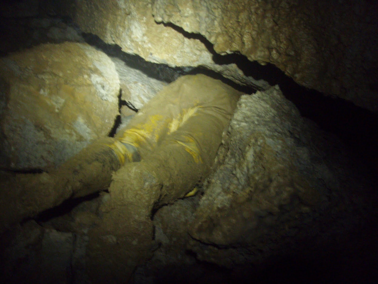
Along at The Elevator I took my time descending down what is still a bit of a dodgy pitch, what with all the hanging death up above, a false floor part way down and tonnes of shattered rock at the bottom! It's very interesting down at the bottom, but given how the pitch got it's name in the first place (Keith was standing on the big boulder still jammed at the top of the pitch and it dropped about several inches), I wasn't terribly happy wandering about not on the rope, so I headed out. Annoyingly I'd forgotten my camera, so I'll have to go back down again at some point to take some piccies.
Back in Urchin Passage, we realised that we still had some time to spare, so we headed back to Cherty Two Passage. Keith and Pete had done quite a bit of work on the choke and Keith said something about "stick your head through and look up". I had a quick look up and decided that it was probably no more dangerous than a lot of Derbyshire mines, so I crawled in and and stood up. After a bit of hesitation he followed me in and we looked around and carefully didn't touch anything. Most of it looks as though it's now fairly well wedged, but there's one enormous block in the roof on the right hand side that you just can't quite work out what's holding it up and this is the one that they're worried about. That whole side is being held up by some chossy crap at the bottom and as they dig through that they're worried that the whole lot is going to come down. In the early days of progging in there, there were at least two major falls of rock and it's anybody's guess how long the stuff up in the aven will stay up there - it's a seriously dodgy place. Keith admitted that evening that he'd never had the nerve to even crawl inside the hole, let alone stand up in there and he did literally mean just 'stick your head in'. Ignorance is bliss!!!!
Having fetched the progging bar and some other bits and pieces from Cherty Two choke, we returned to Urchin Passage choke and Keith had a poke about. Sadly, the last piece of passage up to the choke proper is the sort of mud that sticks badly (I seem to remember some saying about poo and blankets that seems appropriate), and he was soon covered in the stuff. I debated taking a peek, but then decided that I didn't want to completely cake my SRT kit in mud, it was bad enough just having come through the dig.
After only a short space of time and the removal of a few small boulders Keith said he could see black space up above and suggested that as time was moving on we should come back the next day with the boulder removing kit and see if we could make the hole bigger.

The Sunday morning saw us both caked in sticky mud, but after a fairly short time the hole was big enough for Keith to squirm through. There was a fair amount of rock redistribution, his legs disappeared and he shouted back to say it was OK to come through but to watch my head. To say that it was awkward was probably an understatement as the floor of the small chamber is effectively three or four feet about the floor of the passage you emerge from and the small boulders seemed to conspire with the mud to keep me at the bottom (plus I'm larger than Keith, racing snake that he is, he got the thin genes in the family). The entire chamber is full of breakdown and as Keith pressed on straight ahead, I clambered up to the right and looked up... and then wished I hadn't! It isn't as bad as Cherty Two choke, but I realised that most of the stuff above our breakthrough hole that I thought was ceiling... isn't! It's just sort of wedged in there and the floor is all breakdown.
Keith meanwhile levered a fairly hefty boulder out of the way and inserted himself through a low bedding into a low rifty bit.

He stuck his head over another boulder and said that he could see more space ahead. We switched places and I took a couple of photos through the smaller hole in an attempt to work out what we might be looking at. They didn't come out very well, but for what it's worth, here's one of them. The obvious hole is about crawling height and the passage beyond looked big enough to stand up in, from what little I could see.

Running out of time again, with Keith thinking of the drive back to Rugby, we decided that rather than try to get through there and then, we'd come back the following week and have another go at it. It was a very excited brother and sister that headed out that day.
The taping went well, from the breakthrough to the alcove on the far side of Three Way Chamber, where we ran out of pegs. We actually got further than we'd expected because we'd been able to use quite a few boulders to secure the tape.
Along at The Elevator I took my time descending down what is still a bit of a dodgy pitch, what with all the hanging death up above, a false floor part way down and tonnes of shattered rock at the bottom! It's very interesting down at the bottom, but given how the pitch got it's name in the first place (Keith was standing on the big boulder still jammed at the top of the pitch and it dropped about several inches), I wasn't terribly happy wandering about not on the rope, so I headed out. Annoyingly I'd forgotten my camera, so I'll have to go back down again at some point to take some piccies.
Back in Urchin Passage, we realised that we still had some time to spare, so we headed back to Cherty Two Passage. Keith and Pete had done quite a bit of work on the choke and Keith said something about "stick your head through and look up". I had a quick look up and decided that it was probably no more dangerous than a lot of Derbyshire mines, so I crawled in and and stood up. After a bit of hesitation he followed me in and we looked around and carefully didn't touch anything. Most of it looks as though it's now fairly well wedged, but there's one enormous block in the roof on the right hand side that you just can't quite work out what's holding it up and this is the one that they're worried about. That whole side is being held up by some chossy crap at the bottom and as they dig through that they're worried that the whole lot is going to come down. In the early days of progging in there, there were at least two major falls of rock and it's anybody's guess how long the stuff up in the aven will stay up there - it's a seriously dodgy place. Keith admitted that evening that he'd never had the nerve to even crawl inside the hole, let alone stand up in there and he did literally mean just 'stick your head in'. Ignorance is bliss!!!!
Having fetched the progging bar and some other bits and pieces from Cherty Two choke, we returned to Urchin Passage choke and Keith had a poke about. Sadly, the last piece of passage up to the choke proper is the sort of mud that sticks badly (I seem to remember some saying about poo and blankets that seems appropriate), and he was soon covered in the stuff. I debated taking a peek, but then decided that I didn't want to completely cake my SRT kit in mud, it was bad enough just having come through the dig.
After only a short space of time and the removal of a few small boulders Keith said he could see black space up above and suggested that as time was moving on we should come back the next day with the boulder removing kit and see if we could make the hole bigger.

Keith lying in the mud at the end of Urchin Passage
The Sunday morning saw us both caked in sticky mud, but after a fairly short time the hole was big enough for Keith to squirm through. There was a fair amount of rock redistribution, his legs disappeared and he shouted back to say it was OK to come through but to watch my head. To say that it was awkward was probably an understatement as the floor of the small chamber is effectively three or four feet about the floor of the passage you emerge from and the small boulders seemed to conspire with the mud to keep me at the bottom (plus I'm larger than Keith, racing snake that he is, he got the thin genes in the family). The entire chamber is full of breakdown and as Keith pressed on straight ahead, I clambered up to the right and looked up... and then wished I hadn't! It isn't as bad as Cherty Two choke, but I realised that most of the stuff above our breakthrough hole that I thought was ceiling... isn't! It's just sort of wedged in there and the floor is all breakdown.
Keith meanwhile levered a fairly hefty boulder out of the way and inserted himself through a low bedding into a low rifty bit.
Keith disappearing into the next hole
He stuck his head over another boulder and said that he could see more space ahead. We switched places and I took a couple of photos through the smaller hole in an attempt to work out what we might be looking at. They didn't come out very well, but for what it's worth, here's one of them. The obvious hole is about crawling height and the passage beyond looked big enough to stand up in, from what little I could see.

Friday, 5 March 2010
Badby Woods, Northants
Jill and I had lunch at the Coach & Horses at Ashby St Ledgers and then headed over to Badby Woods for a wander. We walked through the east side of the wood to the entrance into Fawsley Park.


This one, in particular is one of my favourite trees and needs hugging on a regular basis!!!

Fawsley Park

From there we followed the edge of the wood to visit the beautiful beech trees that inhabit the top of the hill.


Wednesday, 24 February 2010
Middleton Top, Slaley, Ible, Grangemill, Limestone Way, High Peak Trail
Niki phoned me just after I got up and said that she was up for a walk and there hadn't been much snow after all. I picked her up at Bank Top, as usual, running a bit close to time, but it only took us ten minutes to drive to Middleton Top.
We congregated in the icy car park and set off soon after 10am - Peter, Paul C, Jill, Mike, Phil and us. Peter said he'd been persuaded to join us, but he planned to take a short cut.
We set off across the fields to Middleton in thick fog, turned down the road towards the Via Gellia, then picked up a footpath that took us across a field and into the woods down the steep side of the valley. We took a short detour to Good Luck Mine...


and sat in the coe and had a hot drink before continuing down to the Via Gellia. We followed the road around the bend - Niki found a nice shovel on the way (as you do) - and took a small path up the hillside on the other side of the valley, which was steep and slippy. Just below a pump house we crossed a couple of streams and continued up the hill to the east-ish to Slaley. We then followed the muck wagon a short way up the hill and popped into the Bonsall Moor fields and out onto the lane again, effectively cutting the corner. I got very confused at that point about what part of the Limestone Way we were on and suggested that we were heading for Winster, but actually we were on the Ashbourne section, so headed for Ible, as intended.

Peter left us at Leys Farm and we became six as we continued on across the fields to Ible - what an odd place, no more than half a dozen houses and a couple of farms clinging to the top of the hill. Cute cows though!!

We then followed a lane down to the main road and headed down to Grangemill and the Hollybush. The pub was closed (it's up for sale again), so we sat on some benches around the side and had our butties, which was pretty chilly and the road was busy so it was pretty noisy too, but it was somewhere to sit.
Lunch over, we crossed the junction diagonally and continued up a track...


that took us around the back of Longcliffe Quarry. By this time the fog was beginning to lift a bit.

It's big!! As we continued along the Limestone Way, we came over the top of the hill and within view of the B5062 again - I never even realised there was a footpath up there!


We went to the wrong corner of the last field, but soon clambered over a stone stile onto the High Peak Trail - thank God! We still had a good walk, mostly in deep slush, but at least we were on the home straight. We passed Harborough Rocks and followed Manystones Lane...

through a tunnel...
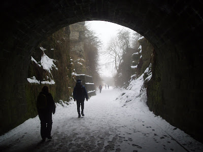
and back to Middleton Top. I was so knackered and stiff! Why does walking on the flat always do that to me?
We congregated in the icy car park and set off soon after 10am - Peter, Paul C, Jill, Mike, Phil and us. Peter said he'd been persuaded to join us, but he planned to take a short cut.
We set off across the fields to Middleton in thick fog, turned down the road towards the Via Gellia, then picked up a footpath that took us across a field and into the woods down the steep side of the valley. We took a short detour to Good Luck Mine...

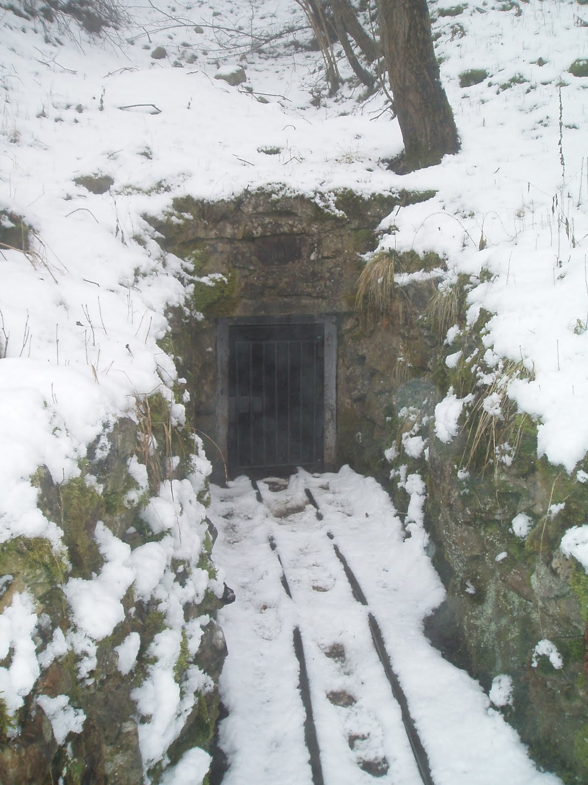
The gated entrance to Good Luck Mine

L-R: Phil, Peter, Paul, Jill, Mike and Niki
and sat in the coe and had a hot drink before continuing down to the Via Gellia. We followed the road around the bend - Niki found a nice shovel on the way (as you do) - and took a small path up the hillside on the other side of the valley, which was steep and slippy. Just below a pump house we crossed a couple of streams and continued up the hill to the east-ish to Slaley. We then followed the muck wagon a short way up the hill and popped into the Bonsall Moor fields and out onto the lane again, effectively cutting the corner. I got very confused at that point about what part of the Limestone Way we were on and suggested that we were heading for Winster, but actually we were on the Ashbourne section, so headed for Ible, as intended.

The lone figure of Peter disappearing into the clag
Peter left us at Leys Farm and we became six as we continued on across the fields to Ible - what an odd place, no more than half a dozen houses and a couple of farms clinging to the top of the hill. Cute cows though!!

Lunch over, we crossed the junction diagonally and continued up a track...

Prospect Quarry, on the northern side of the Via Gellia

A dead pylon near the quarry
that took us around the back of Longcliffe Quarry. By this time the fog was beginning to lift a bit.

Longcliffe Quarry - this is only a small part of it
It's big!! As we continued along the Limestone Way, we came over the top of the hill and within view of the B5062 again - I never even realised there was a footpath up there!


We went to the wrong corner of the last field, but soon clambered over a stone stile onto the High Peak Trail - thank God! We still had a good walk, mostly in deep slush, but at least we were on the home straight. We passed Harborough Rocks and followed Manystones Lane...

Trees looming in the fog on the other side of Manystones Lane
through a tunnel...

and back to Middleton Top. I was so knackered and stiff! Why does walking on the flat always do that to me?
Sunday, 21 February 2010
Robin Hood's Stride in the snow
We woke up and found that six inches of snow had been dumped overnight and the world had turned white all over again. In the early afternoon, we decided to go out for a walk. We went out onto the Limestone Way, up to Robin Hood's Stride, then back down to the road, up onto the knoll at the end of Birchover Wood, along the footpath above Birchover Wood, visited the emus at Upper Town farm and then back across to Winster. It was surprisingly tiring!!


Grey Tor

The Limestone Way

Looking across the fields towards Elton

Robin Hood's Stride

Looking south towards Winster
Saturday, 20 February 2010
Stoney Middleton, Eyam & Foolow
Had breakfast at Outside. Parked at the A623 car park at the bottom of Stoney Middleton Dale and walked back down through the village, past the 'Roman' baths (which aren't Roman, but are thermal) to pick up a track. We followed the track up to a lane where we got some fantastic views of the eastern edges.

The view north towards Grindleford
Crossing the lane we headed into a field, up through a small valley in the woods and out onto another lane.

Looking south across Stoney Middleton Dale and Coombs Dale
We turned left onto the lane and followed it a short way to a stile into the field where the 'Riley Graves' are, where the Hancock(e) family is buried.

The Riley Graves
The information board at the bottom of the lane reads:
"You will see grave stones where Mrs Hancock buried her husband and six children, victims of the plague, between the 3rd and 10th August 1666. The Hancock's farmed this field, known as Riley's field.
Riley comes from 'Rois Ley's', which means 'King's Field'. It was part of William the Conqueror's Royal Hunting Ground."
After taking some photos of the gravestones, we followed the lane the rest of the way down into Eyam. Turning right by a café with a phenomenal choice of cakes, we followed Water Lane up out of the village, and picked up a path that rises steeply across fields, up through the woods...

Looking southwest to the western most end of Stoney Middleton Dale

Looking back down the hill to Eyam
and out onto the edge before heading further north onto a lane, which we crossed and continued north past Ladywash Mine...

Ladywash Mine
Ladywash farm...

Ladywash Farm
and out onto Sir William Hill Lane.

Sir William Hill Lane
We turned left onto that too and followed it out onto the lane that runs along the top of the ridge to Bretton and the The Barrel Inn pub. We took the left fork just past the pub and dropped down towards Foolow. We stopped for lunch just north of the village at a 'wayside' well.

Wayside well just north of Foolow

Stone cross and Methodist chapel in Foolow
As we left Foolow, we heard the sound of many horses following us through the village and then had an entertaining time watching the hunt riding across the fields, jumping walls (or not!) and generally going around in circles, as we headed across the fields towards Eyam. We finally dropped down a large open 'park-like' field, and down through the village.

The Eyam village 'map' at the craft centre

Sundial on Eyam church

Celtic Cross, thought to date from the 8th century, in Eyam churchyard

The boards list the huge variety of cakes that this cafe in Eyam has
We stopped off at the cake café for tea and a hot sausage roll, and then followed Lydgate Lane out of Eyam, across the fields to the main field on the hill past the boundary stone.

The boundary stone
In 1666, during the outbreak of plague in Eyam, the story goes that the villagers left money for their supplies in the holes on the top of the stone, filled with vinegar to sterilise the coins.

The Derwent Valley

Paul on the path down to Stoney Middleton - note the north facing slope opposite
Subscribe to:
Comments (Atom)