Wednesday, 28 October 2009

Bradgate Park with Jill

Jill and I met just after 11am and headed off up the hill to escape the throngs of people enjoying half term - aagh (forgot that when we agreed to meet!). The weather was better than expected and we enjoyed the sunshine.


The view across the park towards Leicester to the southeast.

After a stop at Old John Tower for a tea break and a chat, where we were mobbed by multi-coloured ladybirds, we started down the hill and discovered a worn out bumble bee, which we moved from the path and deposited on some rocks.  We tried to ply it with Jill's special chi tea, but it wasn't impressed, so we left it to its own devices and headed on.

Out in the open we came across some people stalking (for want of a better word) some Red deer stags, with very large antlers.  We opted for the cowardly approach and headed off across the bog, far away from the main path.  They were probably quite safe, but neither of us wanted to risk it, so close to the rutting season.

In the end our tree was in sight and we stopped for lunch, watching some Fallow deer stags grazing close by.


Our 'lunch' tree.


Fallow deer grazing under the trees.

After another break for a pot of tea and a shared piece of ginger cake at the cafe, we followed the 'road' back to the main car park and parted company around 4pm.  What a lot of talking we did... as usual!


Bradgate House, where Lady Jane Grey was born.


The war memorial and Old John Tower on the skyline.

Sunday, 25 October 2009

Stoke Ford & Eyam Moor - Showers & Rainbows

Parked by the pub at Leadmills and set off up the Abney Road, taking a right-hand turn, then crossing the Highlow Brook and then up the fields past __________ (a very grand place) to arrive back on Abney Road.


View back across the fields to the old railway buildings in Hathersage


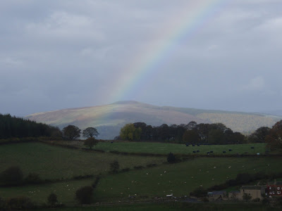
Rainbow over Win Hill


Heading up the field next to _________ (rooftops in view)


Another rainbow over Win Hill


 Rainbow over Hathersage


Almost immediately, we were off the road again and following a track past Tor Farm and along the valley  through Highlow Wood and then climbing up above Highlow Brook opposite Mill Wood.


Autumn colours


Climbing away from Highlow Brook


Looking back down the valley, Higgar Tor and Millstone Edge on the horizon


The view upstream, through to Abney Clough

We stopped in a sheltered spot for a bite to eat and a hot drink and then continued on to Stoke Ford, the meeting point of Highlow Brook and Bretton Brook.


Above Stoke Ford, looking up Abney Clough


Bretton Clough

From Stoke Ford, we turned south and climbed up parallel to Bretton Brook and the Clough, up onto the edge of Eyam Moor.


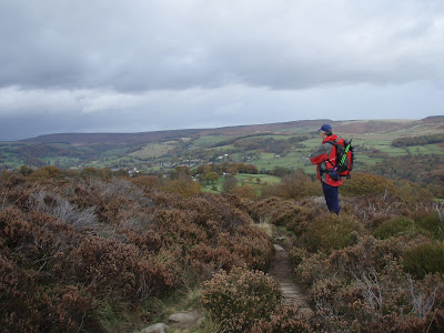
Looking back towards Hathersage across the lower slopes of Eyam Moor


Double rainbow over the Derwent Valley


Rain coming in from Kinder


View from Eyam Moor

We cut across the moor to the wall and followed it all the way across the moor to Sir William Hill Road and then back across another part of the moor to drop down past Leam and pick up the road to drop back down to Leadmills, with a brief detour across a field to Hazelford Hall.


Dropping down the field to Hazelford Hall


Hazelford Hall

Saturday, 24 October 2009

Cistern Clough & Flash


We knew it was going to rain.  Boy, did it rain!  We parked up just off the A53 in a layby that was originally a loop of road and headed off across a very soggy Orchard Common.  At this point it was raining horizontally and visibility was pretty much zero (the photo below really doesn't do it justice!).


Orchard Common in the rain

As we dropped down into the valley and picked up a small lane, the rain stopped and the day began to look up as we followed an increasingly pretty stream.


As the lane ended, and we followed a track that continued down the valley until we finally came to Three Shires Head and Pannier Pool.  Another stream, actually the River Dane, joined the first from the right (north) at a point where Derbyshire, Staffordshire and Cheshire meet.  Apparently this has been a place for dodgy deals in the past, when outlaws could evade lawmen by simply crossing into another county.  It seemed far too pretty a spot to have such a shady past.

The trees and small bridge reminded me strongly of Robbers Bridge in Exmoor and we crossed the stream we'd followed and perched on a wall under the trees to have our lunch.


Looking north to Pannier Pool

After our brief break we crossed the far bridge and followed the track for about half a mile before I realised that we were actually heading in the wrong direction, so we did a U turn and went back to the bridge and along the other bank.  The track was very sandy, turning to lose stone in what was clearly a very old track and we climbed along the side of the hill until we reached tarmac again.


We followed the lane for a mile or so, stopped just off the road for lunch and then, as we left the road once again to climb steeply up the side of Wolf Edge, the heavens opened and we got soaked again. 


The climb up to Wolf Edge

Squelching into Flash a little while later, I heartily wished that the car was once again parked behind the pub, but it wasn't and so we continued through Northfield Farm, past some very soggy horses, who eyed us warily as we flapped past (it was very windy and our waterproofs were making an awful din).


Chrome Hill, Parkhouse Hill, Hitter Hill, Alderly Cliff and High Wheeldon

Having crossed the A53, our way lead down a track to Nield Bank and then up over the hill to Summerhill.  The views over towards Crowdecote was quite stunning, particularly as patches of sunlight lit them up.  Once again we missed our way as we followed the road along, trying for the perfect photograph.

We dropped down a sunken lane across the fields until we picked up a lane that took us back up the hill (steeply!) to the A53, just across the road from where we'd left the car.

Sunday, 18 October 2009

Onecote & Butterton

Had a leisurely start and Paul drove us out through Hartington to Onecote (pronounced on-cot).


Walking in lovely warm sunshine, we headed off north to Mixon Mine Farm where we found some unusual artefacts!!


There had obviously been a lot of landscaping in the vicinity of the mine workings, including a new ramp leading down to a small lake, and we were temporarily confused and couldn't find our way on.  Once sorted, we crossed the stream and then stopped for a snack and a cup of tea/coffee.  By this time, it had clouded over unfortunately and the wind was chilly.

We then continued up over the ridge and down to Black Brook Farm, which was a rather dilapidated, but potentially very beautiful old farmhouse with outbuildings and 50 acres that I fell in love with. This photo, taken from the property's particulars, gives a taste of the place.  Now all I need is £430,000!!!


Black Brook Farm

At the top of the drive, we crossed the road we'd driven down earlier and dropped down into Butterton, a rather pretty, apparently up-market village, with some weird blue/green/purple, iridescent ducks.


Blue ducks in Butterton

As we left the village, we crossed a series of thirteen stiles in the walls of very long, narrow fields, a relic from the farming methods of centuries ago.  All the fields had frontage to the road and all fields dropped down to the stream - a very sensible system as everyone gets access to the same facilities and no-one gets a bog field.


Looking back towards Butterton

At the very top of the hill we crossed a road and came to Grindon Moor, which came as a complete surprise in the middle of all the fields.  It's not a very big piece of moorland, but all heather and bog nonetheless.  After another stop to empty our flasks, we continued off the moor onto a track that took us back into Onecote.

Saturday, 17 October 2009

Lud's Church etc

We parked in Flash, over in the midst of the Staffordshire moorland and crossed the fields to the Bald Stone, an outcrop across the valley north of the Roaches.


The Bald Stone

At the end of the line of outcrops, we dropped down into the valley and followed the small Black Brook as it wound it's way along the bottom of the valley into Gradbach Woods.


Looking back to the south east along the Black Brook

Once past the buildings of Goldsitch Farm, we stopped for a bite to eat where the stream wound it's way through a narrow valley.


Paul enjoying his lunch

After our break we crossed the stream and climbed up away from the water across open moorland, with expanding views across the woodland below.


Looking across the moorland towards Gradbach Wood and Hill

We finally emerged came to a track at an outdoor education centre and shortly afterwards took a stile through the wall and started dropping back down into the trees of Black Forest. The woods were beautiful, with the leaves just starting to change, particularly the beeches. We followed a path along the very top of the woods for about a kilometer until we came to a path to the left that was signposted for Lud's Church - this we followed.


Lud's Church


Lud's Church


Lud's Church is a natural split in the gritstone caused by a landslip, but it gets the second half of its name from the fact that the Lollards, followers of John Wycliffe in the early 15th century, used it as a place to worship. There's supposed to be an air of peace and tranquility about the place (so I've read), but frankly I found it spooky!!! Probably not helped by the fact that after walking for several miles in perfect solitude, we were suddenly mobbed by a horde of people.  I just wanted to run away!!

We stopped a little way away in a small valley off the main path and had our lunch and then continued onto a track that lead down through Forest Wood into the bottom of the valley to cross the Black Brook and take us into the grounds of the Gradbach Youth Hostel.


The Black Brook near Gradbach Youth Hostel

Walking through the grounds of the Youth Hostel we followed the road up the valley for about a kilometre, until we crossed the river and a small field, took another short section of road, before heading along the top of a ridge through the fields with spectacular views in all directions.


Looking back towards Gradbach Youth Hostel

Our route from there was a little convoluted and involved crossing open boggy ground, dropping to a stream, following it upstream through a very overgrown scrubby area, more fields...


Sheep and llamas


some strange sheep, another stream with a small waterfall and then out onto a very steep section of road that shortly lead back to the village of Flash and the car.


The view behind - any excuse to stop and catch my breath!!

Saturday, 10 October 2009

Rowarth, Cown Edge & Lantern Pike

An 8 mile walk from Rowarth near Hayfield.  It was a very murky morning, but the low cloud was breaking up as we set off up the hill northwest of Rowarth.


Across the fields we took a slight detour to visit Robin Hood's Picking Rods.  They're very old, that much is obvious and may date back to Anglo-Saxon times.  There's some conjecture that the stones may originally have been one single column that was broken and later placed roughly into an undressed piece of stone.  One 'theory' is that the stones were used by Robin Hood and his men to stretch their bows.  Another theory is that they may have been preaching stones or grave markers in Anglican times.  The most likely, and certainly what I'm inclined to think, is that they mark the meeting of a number of boundaries within the forest that used to cover that area - probably a 'hunting' forest that than woodland.


Paul at Robin Hood's Picking Rods

We continued until we reached the southern end of Cown Edge. There were several pairs of ravens flying about.


At the far end of Cown Edge, we dropped down to the road and followed it for maybe a mile before stopping briefly for another snack and then back into the fields.  After a mixture of following lanes and paths through fields, we found ourselves on a track running to the east of Lantern Pike.  The book said that it was worth a visit right to the top of the hill, so off we went - the book was right, to the east were fabulous views right across to Kinder Downfall.


 The view to the south across Hayfield


Having dropped back down to the track we followed this down to the road and circled the end of the ridge to follow a track back along the other side of the ridge, heading back towards Rowarth.


Back in the village proper, we came upon the village pub, the Little Mill Inn, which we hadn't seen when we parked and walked off north.  There was a leat from the small river taking water to a large diameter overshot waterwheel.